City population, growth rate, and income (GDP per capita)
What the scatterplots can tell
These two scatterplots are messy at first glance, but the more I look at them the more stories I could see. Of course, maybe these findings can be illustrated separately in better ways.
#1. City GDP per capita vs Log City Population Size

The observations are:
- The first observation is that there is no pattern in the data points, meaning GDP per capita in the world correlates very weakly with the size of the city.
- All the cities in the more developed regions (marked as triangles) are on the top. This is not surprising as the y-axis is income level (GDP per capita). What is interesting is that the distributions of population size for the developed region and developing region seem very close.
- There is a natural stratification by the 8 geological regions. This is the 3rd finding: the main difference among regions besides their geological location is their income level.
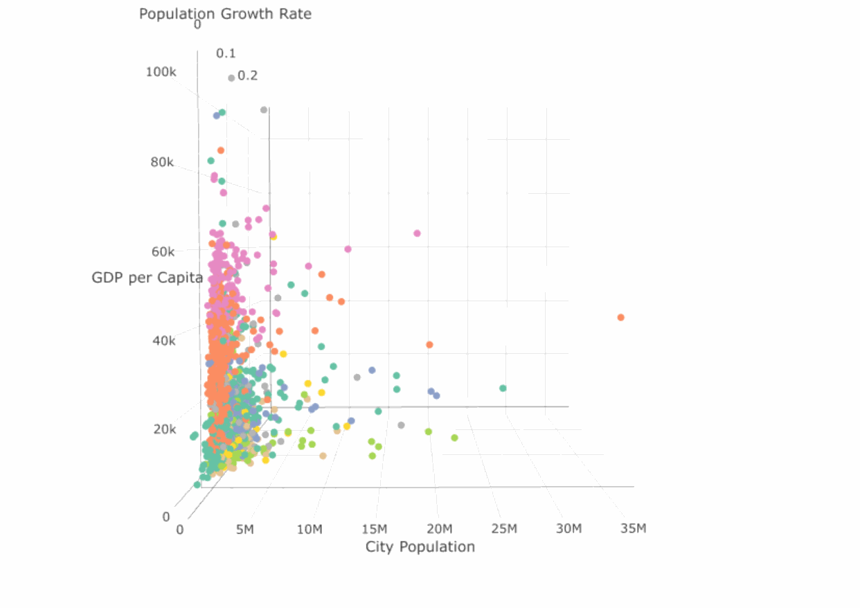
A 3D view (Population is on the original scale, still colored by region):
#2. City Population Growth Rate vs. Population Size

The population size is on log-scale.
- The growth rate of city population size clearly does not associate with city population size
- A little bit hard to observe, but most triangles (cities developed region) are around zero: A clear difference in population growth rate between developed and developing countries.
- Again there is a stratification by color, indicating that population growth rates vary significantly across the eight regions. Cities in developing countries (warm color) generally have higher population growth rate.
A 3D view (Population is on original scale):


Comments